Survey Engineering Technician

Survey technicians are in demand in many industries. Using instruments and computer software, survey engineering technicians conduct field measurements and analyze data to determine the precise locations of natural features, structures and property boundaries.

Home / Learn / Programs List / Survey Engineering Technician
Credential
Ontario College Diploma
Duration
Four semesters
Start Date(s)
September (Fall)
Locations
Belleville
Open to
Domestic Students
CIP Code
15.1102

Find your career

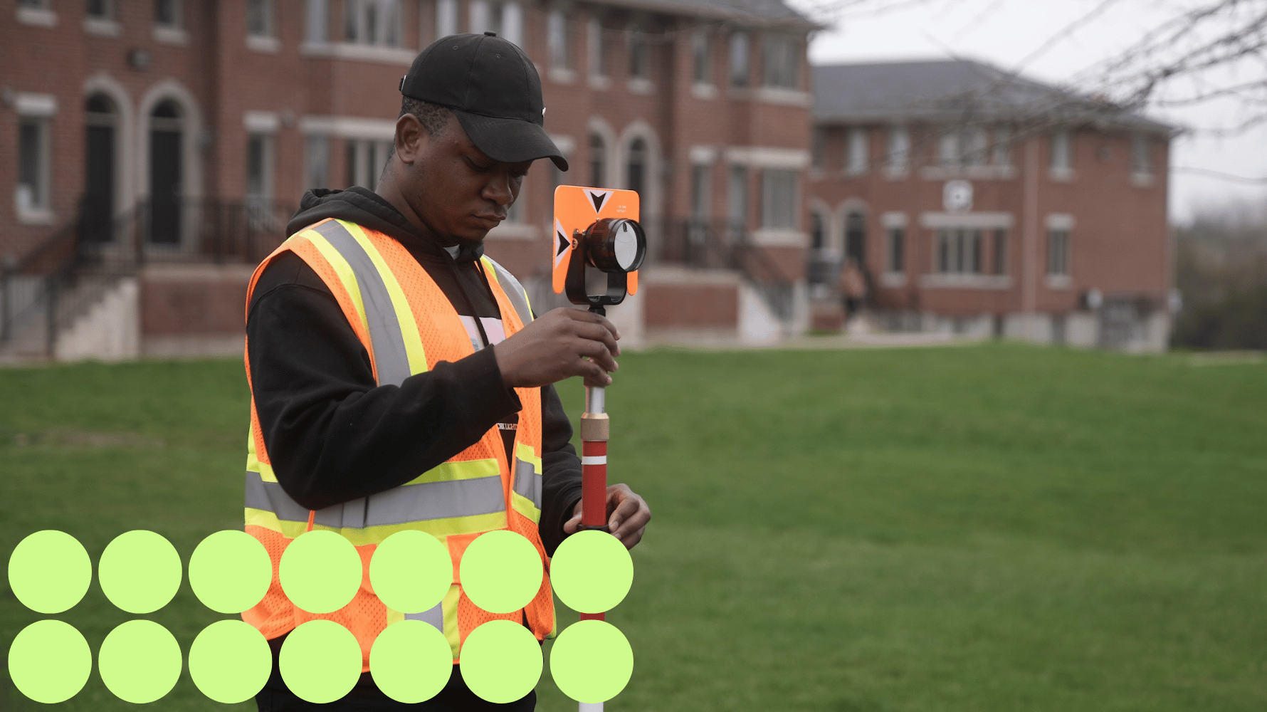
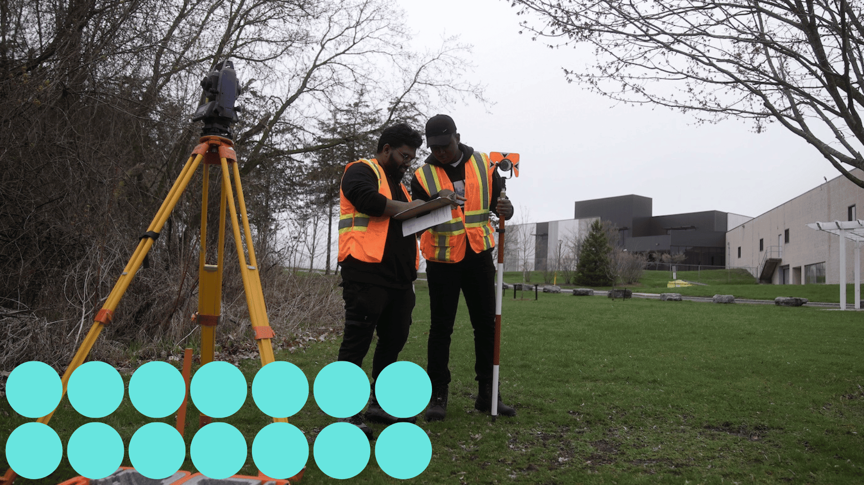
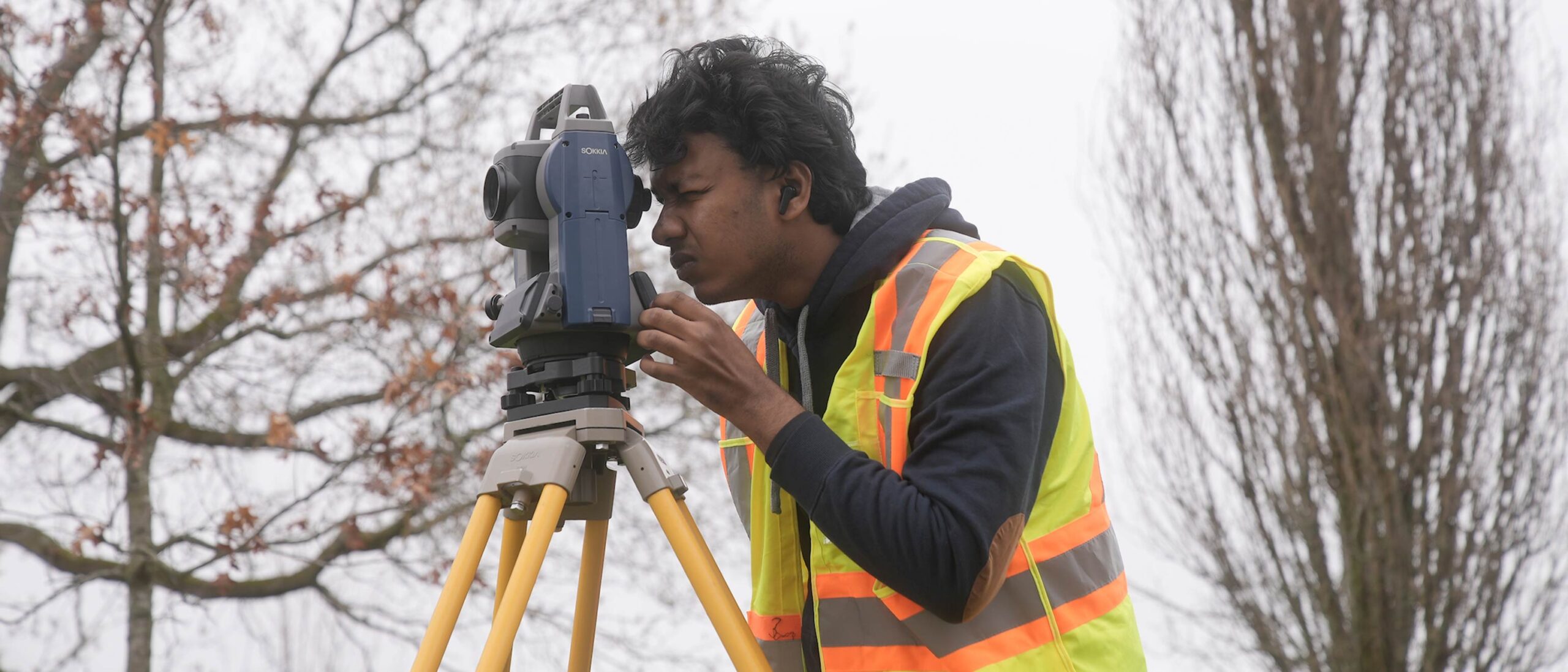
Surveying is the foundation of most engineering projects. You might be involved in: 

  • Working with many industries, including construction, land development, government agencies, and mining and natural resource exploration. 
  • Pre-engineering surveys, laying out proposed structures and locating existing improvements. 
  • Assisting an Ontario land surveyor in locating property boundaries. 
  • Gathering data for use in geographic information systems.

Our grads get great jobs

  • Survey Technician, Gifford Harris Surveying Ltd. 
  • Junior Party Chief, Mission Geospatial Ltd. 
  • Instrument/CAD Person, Marshall Macklin Monaghan Ltd. 
  • Junior Inspector, GD Jewell Engineering Inc. 
  • Paving Superintendent, Villeneuve Construction Co. Ltd.

This program has opened doors to opportunities I wouldn’t have had without coming to college. I learned to work with MicroSurvey, use AutoCAD and test the equipment surveyors use in the field. The hands-on experience I’ve gained will be invaluable as I start my career.

Is it for you?

This can be a rewarding career for people who: 

  • Are curious and investigative. 
  • Like mastering the latest technology. 
  • Are physical and enjoy spending time outdoors. 
  • May enjoy running a crew or managing an office space.

How you'll learn

Experiential learning 

Learning combines classroom instruction with computer lab and practical field exercises: 

  • Loyalist College offers the only specialized program for survey technicians in Ontario which prepares students for high-demand careers in cadastral land surveying and geomatics engineering. 
  • Gain extensive hands-on field surveying experience using current satellite positioning equipment (GNSS), total stations, and data collectors during practical survey projects on our wooded 200-acre Belleville campus. 
  • Using current versions of industry software including MicroSurvey, AutoCAD and AutoCAD Civil 3D, create a registered plan of a subdivision and engineering drawings for land development applications and highway design according to provincial and municipal standards. 
  • Make valuable job connections during an industry work placement. 
  • Graduates are eligible for certification with the Ontario Association of Certified Engineering Technicians and Technologists (OACETT). 

Outstanding faculty make the difference 

Learn in small classes with one-on-one attention from faculty: 

  • Faculty include experienced Ontario Land Surveyors and Registered Professional Engineers who have worked in government, private industry and built their own business.
  • Professors have specialized experience with Global Information Systems and integrating Global Positioning Systems into automated machine control for heavy equipment. 
  • A wide network of industry contacts helps connect students with placements and jobs across the country.

Courses

CARC1000 Building Construction, Codes and Standards 1

This course is an introduction to typical construction methods and standards for houses and small buildings in Ontario. Part 9 of the Ontario Building Code is a major focus with particular attention to site work, footings, foundations, floor systems and stairs. The roles and responsibilities of architectural and construction professionals are reviewed.

CONS1008 Building Methods & Materials

Students will investigate the primary materials used in the construction industry. Students will work with aggregates, concrete, wood, steel and asphalt, practicing the methods and using the equipment associated with each material.

CIVL1000 CAD 1

Students will use basic commands in drafter and design applications to create, edit, store and retrieve drawing data. Through simple drawing assignments, students will develop foundational drafting skills. Students will also interpret construction drawings to build plan-reading skills related to construction documentation.

CIVL1001 Engineering Applications

Students will apply software to solve engineering problems, improve design efficiency and support planning analysis and management of engineering projects.

CONS1002 Health & Safety-Construction

Students will learn about health hazards and safety risks present on construction sites. Students will navigate the Occupational Health and Safety Act and Regulations for Construction Projects, applying their knowledge to promote safe work environments for themselves and others.

MATH1012 Math 1

Students learn to use the mathematical tools that are required in their engineering subjects. Building sciences applications of algebra, geometry and trigonometry are emphasized.

SURV1016 Surveying

Students will be able to explain the role of the survey technician in communicating land-related information among industry stakeholders in engineering and construction. They will be able to accurately measure angles, distances and elevations, record field data and apply surveying theory while developing practical skills using automatic levels, total stations, electronic data collectors and GNSS receivers through hands-on field exercises.

SURV1015 Advanced Field Surveying

Students will be able to perform advanced field operations using a wide range of survey instruments while applying standard field procedures and producing clear, accurate field notes. They will be able to operate and integrate laser levels, robotic total stations, electronic data collectors, GNSS receivers and magnetic locators to collect and manage precise field data, including high-precision and control surveys, during practical field exercises.

SURV1013 Geographical Info System

Students will be introduced to the principles and applications of Geographic Information Systems (GIS) for collecting, managing, analyzing and visualizing spatial data. Students learn how GIS supports decision-making in fields such as urban planning, civil engineering, environmental management and infrastructure development. Prerequisite: CIVL 1000

SURV1018 Heavy Construction Methods

Course description not available

CIVL1004 Highway Engineering

Students will study the geometry of Canadian highways and analyze how factors such as design speed, climate, traffic flow and vehicle characteristics influence road design. Students will calculate minimum highway radii, determine the use of transition curves, evaluate cross-section adjustments, design vertical curves and prepare documentation to guide roadway construction. Prerequisite: MATH 1012, ( SURV 1000 or SURV 1014 )

SURV1017 Survey Drafting and Computations

Prerequisite: CADD 1004 or CIVL 1000

COMM1002 Technical Communications

Students develop communication skills for the presentation of technical information in business documents that meet the needs of clients and customers. Documents and presentations are produced in Word and PowerPoint.

GNED1100 Becoming a Global Changemaker

This Loyalist College graduate attributes course will help shape your perspectives, broaden your understanding of important issues affecting our societies today, and equip you with invaluable knowledge and skills that will inform your ability to influence your community in a meaningful and impactful way. By exploring topics such as cultural competency, Indigenous education, entrepreneurship, sustainability, health and wellness, and ecological literacy, you'll be equipped with a powerful toolkit that extends far beyond the classroom.

SURV2010 Cadastral Surveying

Learners will describe and apply the fundamental principles of cadastral surveying within Ontario, focusing on boundary identification, evidence evaluation and field procedures. They will interpret legal survey frameworks and apply practices related to monumentation and boundary retracement. Learners will also develop an understanding of the field technician’s role in supporting property surveys, emphasizing accuracy, documentation and professional responsibility in land boundary determination.

SURV2015 Engineering Surveying

This course is about engineering and construction surveying. It introduces the student to the major steps of surveying within an engineering project: setting up project control, completing topographic surveys including breaklines for terrain modeling, producing, transferring and extracting information with digital media, staking out alignment and grades for construction work. Advanced geomatics concepts such as ellipsoid, geoid, datum, projections, grids and survey adjustments are introduced. Students become proficient at using total station equipment for pickup and layout, and develop confidence in the accuracy and precision of various measuring methods. AutoCAD Civil 3D is used to develop terrain and simple road corridor design used in the stakeout. Prerequisite: SURV 1016

CONS2005 Envir Protect Legislation Cons

Students will examine how construction activities impact the environment, including land, water, air and surrounding communities. Students will explore real-world examples to identify strategies for preventing pollution and complying with permits and regulatory requirements. Students will review environmental legislation and apply this knowledge to make informed decisions that support safe, responsible and sustainable construction practices.

CIVL2002 Highway Technology

Students will be introduced to the principles of designing, constructing and operating roads and highways in Ontario. Prerequisite: ( SURV 1001 or SURV 1014 ) , ( COMP 1003 or CIVL 1001 ) , ( CADD 1005 or CIVL 1003 )

SURV2009 Placement (Survey)

Students are placed with local surveying firms one day per week for 11 weeks of the fall semester. Prerequisite: CONS 1001

SURV2011 Remote Sensing

Course description not available

GNED General Education Elective

SURV2013 Capstone Project

Course description not available

CIVL2010 Construction Management

Course description not available

SURV2014 Geodectic Survey

Learners will explain and apply the fundamental principles of geodetic surveying, including Earth curvature, coordinate systems, datums and high-accuracy positioning methods. They will collect and manage geodetic data to support mapping, control networks and large-scale engineering projects. Learners will also develop an understanding of the field technician’s role in ensuring accuracy and consistency in geodetic measurements, applying data management practices to support reliable spatial information and project outcomes.

SURV2008 Land Use Planning

A study of acts and regulations affecting planning in Ontario together with the survey requirements for the preparation of draft plans of subdivisions. Preparations of final plans of subdivisions are also studied.

CIVL2006 Municipal Engineering

Using Autodesk Civil 3D this course teaches the principles and processes for the creation of municipal road, drainage and services. Students will select a parcel of land and, through the course materials – lectures, demonstrations, text, standards, examples, tutorials and assignments – produce an urban municipal subdivision design. Prerequisite: BLDG 2006 or CIVL 1005

SURV2007 Survey Law

A study of acts and regulations affecting planning in Ontario together with the survey requirements for the preparation of draft plans of subdivisions. Preparations of final plans of subdivisions are also studied.

GNED General Education Elective

*Courses subject to change.

A student in a high visibility vest in a grassy field holds a range rod for a land survey. Green graphic circles are in the lower lefthand corner of the image.

Admission requirements

Required academic preparation 

  • OSSD/OSSGD or equivalent with courses at the general, advanced, (C), (U) or (M) level, AND 
  • Grade 12 English (C) level or equivalent 

 OR 

Recommended academic preparation 

  • Grade 11 and 12 Math (MCF 3M and MCT 4C) 

Academic upgrading

Are you missing admission requirements? Discover how Career and College Prep at Loyalist can help you get started on your journey.

Additional requirements

*Additional materials, trainings and certifications may be required depending on industry partner requirements connected to experiential learning. Pre-placement requirements are subject to change based on placement agency and/or legislative or regulatory changes.

Costs

Approximate costs (2025 – 26, two semesters at full-time student status)* 

  • Domestic Tuition: $2,722.08 
  • Full-Time Ancillary Fees: $1,595.26 
  • Total: $4,317.34 

Additional student-purchased costs may include textbooks, supplies, software, and other resources. Additional expenses related to off-campus experiential learning activities may also be incurred.


*All fees are subject to change. Fees for programs shorter or longer than two semesters will be adjusted accordingly. In addition to the costs listed above, some programs also have program ancillary fees based on their specific requirements. For a detailed breakdown of tuition and ancillary fees – including any program-specific charges – please visit the Tuition and fee schedule 2025–26.

Paying for college

At Loyalist College, we believe that cost should never be a barrier to your success. We’re here to help you navigate the costs of college and connect you with a variety of financial aid programs, resources and donor-supported awards. Explore paying for college.   

Schulich Builders

Students enrolling in this program may be eligible for the Schulich Builders scholarship program. 

Schulich Builders covers tuition, tools and living expenses for students enrolling in a skilled trades program. Loyalist College will award ten scholarships per year: 

  • Five $20,000 scholarships for one-year certificate programs, and 
  • Five $40,000 scholarships for two-year diploma programs

Learn more and apply today! 

Two students in high visibility vests stand together taking writing measurements on a clipboard. Land survey equipment is seen in the forefront of the image. Blue graphic circles are in the lower lefthand corner of the image.

Further study

Pathways and university transfer

What’s next? Build on the knowledge and skills you learned at Loyalist by continuing your academic journey. Return to Loyalist to complete a second diploma or a post-graduate program in as little as a year, or receive credit recognition for your Loyalist studies when pursuing a degree at a university. Explore pathway opportunities.

Professional certification

College graduates must apply to the Ontario Association of Certified Engineering Technicians and Technologists (OACETT) to be certified in Ontario. Loyalist Civil Engineering Technician and Technologist graduates meet the academic requirements for accreditation as a Certified Technician (C.Tech.). Applicants are also required to: 

  • Complete additional work experience. 
  • Provide peer references. 
  • Pass a Professional Practice Examination administered by OACETT, offered four times a year. 

Autodesk certification

Students are eligible to take the Autodesk certification exams at Loyalist College. Completing these industry-recognized credentials enables students to highlight that they have the in-demand skills employers are seeking.