Survey Engineering Technician

Survey technicians are in demand in many industries. Using instruments and computer software, survey engineering technicians conduct field measurements and analyze data to determine the precise locations of natural features, structures and property boundaries.

Home / Learn / Programs List / Survey Engineering Technician
Credential
Ontario College Diploma
Duration
Two years
Start Date(s)
September (Fall)
Locations
Belleville
Open to
International Students
Domestic Students

Find your career

Surveying is the foundation of most engineering projects. You might be involved in: 

  • Working with many industries, including construction, land development, government agencies, and mining and natural resource exploration. 
  • Pre-engineering surveys, laying out proposed structures and locating existing improvements. 
  • Assisting an Ontario land surveyor in locating property boundaries. 
  • Gathering data for use in geographic information systems.

Our grads get great jobs

  • Survey Technician, Gifford Harris Surveying Ltd. 
  • Junior Party Chief, Mission Geospatial Ltd. 
  • Instrument/CAD Person, Marshall Macklin Monaghan Ltd. 
  • Junior Inspector, GD Jewell Engineering Inc. 
  • Paving Superintendent, Villeneuve Construction Co. Ltd.

Is it for you?

This can be a rewarding career for people who: 

  • Are curious and investigative. 
  • Like mastering the latest technology. 
  • Are physical and enjoy spending time outdoors. 
  • May enjoy running a crew or managing an office space.

How you'll learn

Experiential learning 

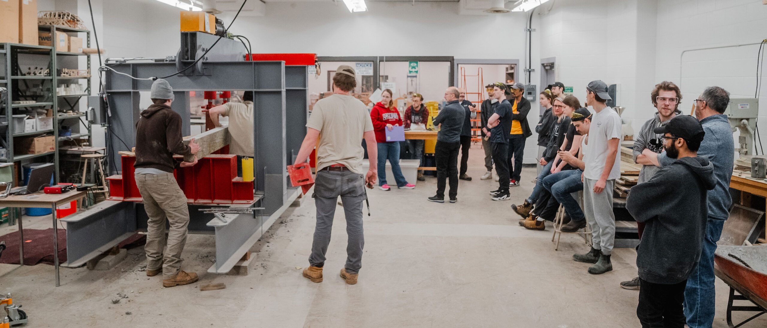
Learning combines classroom instruction with computer lab and practical field exercises: 

  • Loyalist College offers the only specialized program for survey technicians in Ontario which prepares students for high-demand careers in cadastral land surveying and geomatics engineering. 
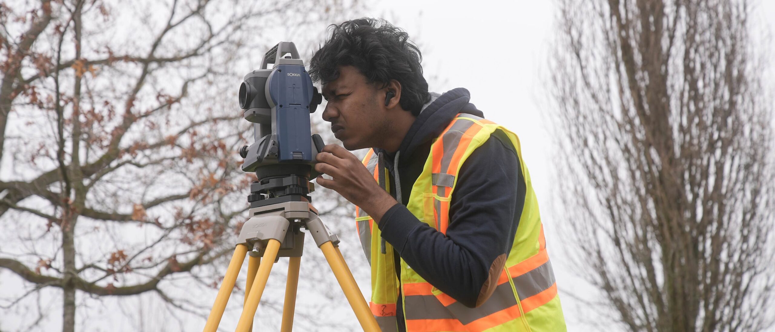
  • Gain extensive hands-on field surveying experience using current satellite positioning equipment (GNSS), total stations, and data collectors during practical survey projects on our wooded 200-acre Belleville campus. 
  • Using current versions of industry software including MicroSurvey, AutoCAD and AutoCAD Civil 3D, create a registered plan of a subdivision and engineering drawings for land development applications and highway design according to provincial and municipal standards. 
  • Make valuable job connections during an industry work placement. 
  • Graduates are eligible for certification with the Ontario Association of Certified Engineering Technicians and Technologists (OACETT). 

Outstanding faculty make the difference 

Learn in small classes with one-on-one attention from faculty: 

  • Faculty include experienced Ontario Land Surveyors and Registered Professional Engineers who have worked in government, private industry and built their own business.
  • Professors have specialized experience with Global Information Systems and integrating Global Positioning Systems into automated machine control for heavy equipment. 
  • A wide network of industry contacts helps connect students with placements and jobs across the country.

Courses

BLDG1005 Building Methods & Materials

This course deals with materials used in buildings, and the methods and equipment used in constructing with these materials. Materials include: concrete, masonry, wood and steel.

CADD1004 CAD 1

Cad 1 is an introductory course in 2-D computer aided drafting, using the AutoCAD program. The initial focus of the course is to learn and implement basic commands to create, edit, store and retrieve data. This skill and knowledge is developed through basic, simple drawing assignments. Another component of the course is dedicated to developing print reading skills as related to construction documentation.

COMP1003 Engineering Applications

Students are introduced to Microsoft Office software. The basics of Microsoft Word are learned and Microsoft Excel is used with engineering applications.

SAFE2001 Field Safety

In this course students practice the fundamentals of field traversing with emphasis on the use of basic instruments, standard field procedures, and the taking of concise and accurate field notes.

SURV2001 Field Techniques

Students gain additional practice in field traversing using a wider range of field instruments. There is continued emphasis on standard field procedures and the taking of concise and accurate field notes.

SURV1000 Geomatics 1

Geomatics 1 is the first of three courses in surveying offered in the Building Sciences Program and introduces the learner to the survey technologist's/technician's role in communicating land-related information between stakeholders in Architectural/Engineering/Construction (AEC) projects. This dialog is dependent upon the efficient and accurate measurement of angles, distances and differences in elevations and the careful recording of the data gathered. Learners will explore the theory of making measurements during classroom lectures and develop the practical skills of operating automatic levels, total stations, electronic data-collectors, and GPS receivers during weekly field exercises.

MATH1012 Math 1

Students learn to use the mathematical tools that are required in their engineering subjects. Building sciences applications of algebra, geometry and trigonometry are emphasized.

CADD1005 CAD 2

CAD 2 is an extension of CAD1. The objective of this course is to further enhance student's knowledge of the AutoCAD software. Having developed an understanding of basic functions such as geometry creation, editing, dimensioning and annotation, students learn more advanced features of the software to facilitate drawing creation and organization, primarily in a 2-D setting. This will be accomplished by the use of more involved, complex and discipline related projects. A component of the course will also include print reading fundamentals with construction drawings. Prerequisite: CADD 1004 or TECH 8150

SURV1004 Community Planning

A study of acts and regulations affecting planning in Ontario together with the survey requirements for the preparation of draft plans of subdivisions. Preparations of final plans of subdivisions are also studied.

SURV1005 Geodectic Survey

The celestial sphere and spherical trigonometry are introduced as background for the use of astronomy in determination of direction on the surface of the earth. Hand calculators and microcomputer solutions are used in the reduction of field observations.

BLDG1004 Heavy Construction, Methods and Materials

This course deals with materials used in civil engineering works, and the methods and equipment used in construction with these materials. Materials include: soils, concrete, steel, heavy timber, and asphalt.

SURV1001 Highway Technology 1

This course introduces the learner to the geometry of Canadian highways and how various factors such as design speed, climate, traffic flow, and vehicle characteristics affect the properties of proposed roads. Candidates will apply the skills and mathematical techniques introduced in Mathematics 1 and Geomatics 1 to calculate the minimum radius of a highway, determine appropriateness of introducing transition curves, deciding if and when to alter the cross-section of the roadway, when to insert vertical curves, and how to prepare information to control the construction of a roadway. Prerequisite: MATH 1012, SURV 1000

MATH1007 Mathematics 2

This course is a continuation of Mathematics 1. Prerequisite: MATH 1012

SURV2002 Real Property Law

Students study real estate transactions and title searching in Ontario.

SURV1003 Survey Law

Legal Surveying 2

COMM1002 Technical Communications 1

Students develop communication skills for the presentation of technical information in business documents that meet the needs of clients and customers. Documents and presentations are produced in Word and PowerPoint.

BLDG3006 Construction Supervision 1

Students study the role of the construction superintendent with special emphasis on leadership, labour relations, construction management and safety at the site level.

SAFE2001 Field Safety

In this course students practice the fundamentals of field traversing with emphasis on the use of basic instruments, standard field procedures, and the taking of concise and accurate field notes.

SURV2001 Field Techniques

Students gain additional practice in field traversing using a wider range of field instruments. There is continued emphasis on standard field procedures and the taking of concise and accurate field notes.

SURV2000 Geomatics 2

This course is about engineering and construction surveying. It introduces the student to the major steps of surveying within an engineering project - setting up project control, completing topographic surveys including breaklines for terrain modeling, producing, transferring and extracting information with digital media, staking out alignment and grades for construction work. Advanced geomatics concepts such as ellipsoid, geoid, datum, projections, grids, and survey adjustments are introduced. Students become proficient at using total station equipment for pickup and layout and develop confidence in the accuracy and precision of various measuring methods. AutoCAD Civil 3D is used to develop terrain and simple road corridor design used in the stakeout. Prerequisite: SURV 1001, COMP 1003

BLDG2006 Highway Technology 2

This course introduces students to principles involved in the design, construction, and operations of roads and highways in Ontario, building on the basic knowledge gained in Geomatics, Computer Applications, and AutoCAD courses. Topics include road classification, level of service, interpreting topography, drainage requirements, and advanced highway geometry. AutoCAD Civil 3D is introduced to support highway design using Civil 3D Surface, Alignment, Profile, Assembly, and Corridor objects. Prerequisite: SURV 1001, COMP 1003, CADD 1005

WKPL2034 Placement (Survey)

Students are placed with local surveying firms one day per week for 11 weeks of the fall semester. Prerequisite: ( SAFE 2001 or SURV 1002 )

SURV1011 Survey Drafting

This course explores various techniques used to acquire, manage, map, analyze and communicate information based on measurements made on or near the earth’s surface using the latest computer software. Learners will receive a systematic introduction to the terminology used, the software employed to verify and develop data from field measurements, and produce plans acceptable to the stakeholders in the surveying profession. Prerequisite: CADD 1004

SURV2005 Capstone Project

New course - description to follow.

SURV1004 Community Planning

A study of acts and regulations affecting planning in Ontario together with the survey requirements for the preparation of draft plans of subdivisions. Preparations of final plans of subdivisions are also studied.

SURV1005 Geodectic Survey

The celestial sphere and spherical trigonometry are introduced as background for the use of astronomy in determination of direction on the surface of the earth. Hand calculators and microcomputer solutions are used in the reduction of field observations.

MUNI2001 Municipal Engineering 1

Using Autodesk Civil 3D this course teaches the principals and processes for the creation of municipal road, drainage, and services. Students will select a parcel of land and, through the course materials – lectures, demonstrations, text, standards, examples, tutorials, and assignments – produce an urban municipal subdivision design. Prerequisite: BLDG 2006

SURV2002 Real Property Law

Students study real estate transactions and title searching in Ontario.

BLDG3009 Remote Sensing

Using aerial photos and simple instruments, students learn to make quantitative measurements of area and height. Rural and urban terrain features on the photographs are studied for purposes of recognition and evaluation.

SURV1003 Survey Law

Legal Surveying 2

*Courses subject to change.

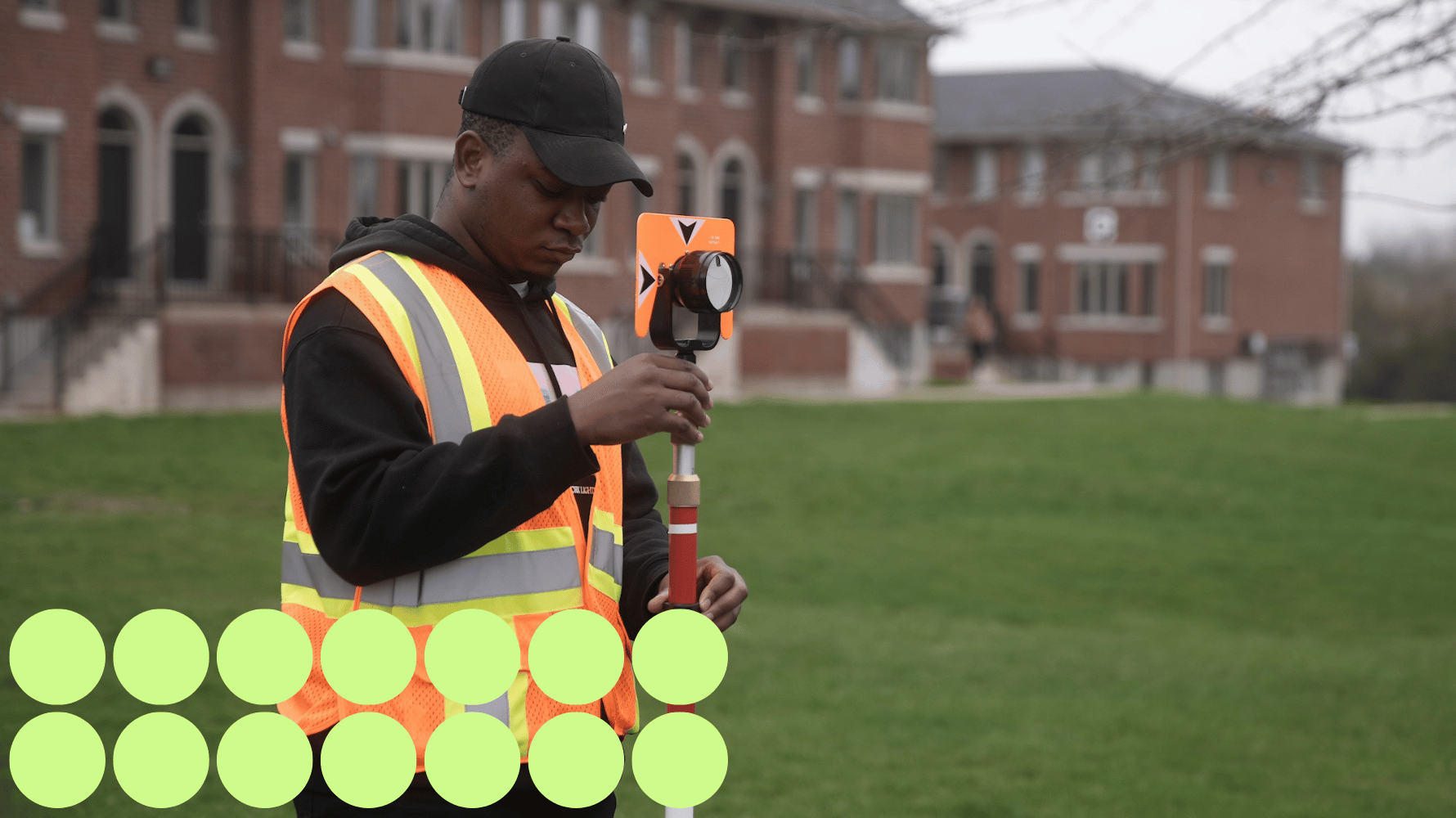
A student in a high visibility vest in a grassy field holds a range rod for a land survey. Green graphic circles are in the lower lefthand corner of the image.

Admission requirements

Required academic preparation 

  • OSSD/OSSGD or equivalent with courses at the general, advanced, (C), (U) or (M) level, AND 
  • Grade 12 English (C) level or equivalent 

 OR 

Recommended academic preparation 

  • Grade 11 and 12 Math (MCF 3M and MCT 4C) 

Prior learning assessment and recognition (PLAR) 

Do you have work experience or other types of non-credentialed learning? Through Loyalist’s PLAR program, applicants and current students may be eligible to receive academic credit for relevant educational, work and life experiences.

International students  

Learn more about admission requirements for international applicants and how to apply.

Costs

Approximate costs (2024 – 25) 

  • Domestic Tuition: $2,722.08 
  • Full-Time Ancillary Fees:* $1,367 
  • Total: $4,089.08 

Additional costs, such as supplies, travel and parking, may be incurred during workplace visits, etc.   

*Fees related to programs that are less than or greater than two semesters will be adjusted accordingly. Fees are subject to change. Please visit the Tuition and fees page for a list of the many services, activities and items included within the ancillary fees, and the related policies. 

Paying for college 

At Loyalist College, we believe that cost should never be a barrier to your success. We’re here to help you navigate the costs of college and connect you with a variety of financial aid programs, resources and donor-supported awards. Explore paying for college.   

Schulich Builders

Students enrolling in this program may be eligible for the Schulich Builders scholarship program. 

Schulich Builders covers tuition, tools and living expenses for students enrolling in a skilled trades program. Loyalist College will award ten scholarships per year: 

  • Five $20,000 scholarships for one-year certificate programs, and 
  • Five $40,000 scholarships for two-year diploma programs

Learn more and apply today! 

Approximate costs (2024 – 25) 

  • International Tuition: $15,000 
  • Full-Time Ancillary Fees:* $1,367 
  • Mandatory Health Insurance: $659 
  • Total: $17,026 

Additional costs, such as supplies, travel and parking, may be incurred during workplace visits, etc.   

*Fees related to programs that are less than or greater than two semesters will be adjusted accordingly. Fees are subject to change. Please visit the Tuition and fees page for a list of the many services, activities and items included within the ancillary fees, and the related policies. 

Paying for college 

At Loyalist College, we believe that cost should never be a barrier to your success. We’re here to help you navigate the costs of college and connect you with a variety of financial aid programs, resources and donor-supported awards. Explore paying for college.   

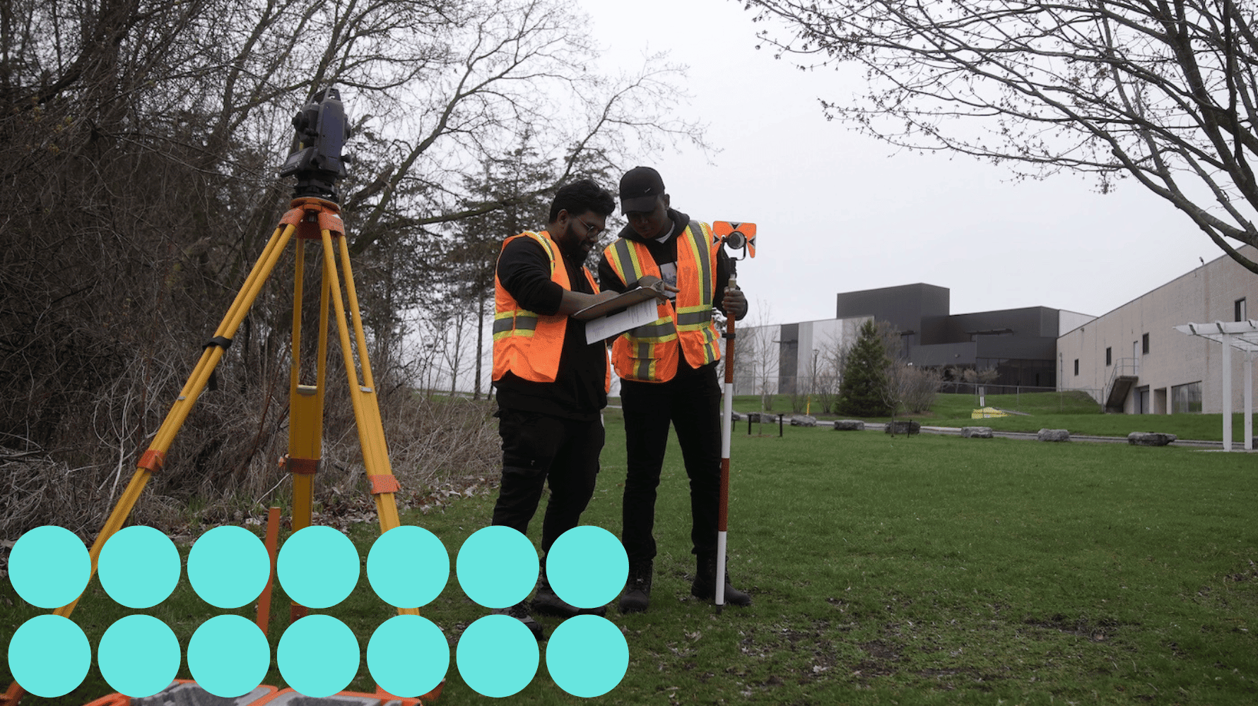
Two students in high visibility vests stand together taking writing measurements on a clipboard. Land survey equipment is seen in the forefront of the image. Blue graphic circles are in the lower lefthand corner of the image.

Further study

Pathways and university transfer 

What’s next? Build on the knowledge and skills you learned at Loyalist by continuing your academic journey. Return to Loyalist to complete a second diploma or a post-graduate program in as little as a year, or receive credit recognition for your Loyalist studies when pursuing a degree at a university. Explore pathway opportunities 

Professional certification 

College graduates must apply to the Ontario Association of Certified Engineering Technicians and Technologists (OACETT) to be certified in Ontario. Loyalist Civil Engineering Technician and Technologist graduates meet the academic requirements for accreditation as a Certified Technician (C.Tech.). Applicants are also required to: 

  • Complete additional work experience. 
  • Provide peer references. 
  • Pass a Professional Practice Examination administered by OACETT, offered four times a year. 

Autodesk certification 

Students are eligible to take the Autodesk certification exams at Loyalist College. Completing these industry-recognized credentials enables students to highlight that they have the in-demand skills employers are seeking.